No job too big,
No job too small
Licensed Surveyors - Consultant Surveyors
|
We have been operating now for 30 years (first as Hill & Hampson, then as Hampson & Associates Ltd since 1988. As of March 31, 2025, we are no longer a limited liability company) and are a small family orientated firm. All our surveyors have currently been with the company for a minimum of 11 years and have a wealth of knowledge in the New Zealand cadastral system and the Local Authority requirements for our region. As such we have a good working relationship with all Councils in the Auckland area and have also carried out several developments in Hamilton, Wellington, Gisborne, and recently the first major unit title in Whakatane. We also have a permanent vehicle and survey equipment on Great Barrier Island where I have been a land owner since 1969. We have been as far north as Houhora in the North Island and as far south as Fairlie in the South Island to carry out surveys for longstanding clients. We are specialists for inner city developments and are very familiar with 3 dimensional land transfer surveys (i.e. fee simple in stratum surveys) and unit title surveys for high rise developments. Our core business however is for residential and rural surveys within the greater Auckland area. We find that the typical "one into two" residential or rural survey is a lot more demanding on our time on a per lot basis because compliance with the requirements of the District Plans tends to be more onerous for these infill subdivisions than when you have a "green fields" situation. We bring our experience from the large multi lot developments to the small residential sites (no job is too big, no job is too small). If you visit Our Projects Page you will see examples of some developments that we have been involved in and a brief description of what we undertook to make the developments a success for our clients. Areas of expertise:
|
The new digital age means that surveyors in New Zealand are now required to use the new LINZ (Land Information New Zealand) Landonline system when lodging survey datasets for approval. Many surveyors feel that the plans produced using this new system have allowed inferior plans to become acceptable. These plans are not only confusing to other surveyors but are causing problems with other professions that rely on our datasets - solicitors, real estate agents, architects and the general public. Where possible, we as a firm have therefore adopted a system that although compatible with the LINZ Landonline requirements, will contain information previously shown within our old paper datasets. This makes our job a little more time consuming as there is a greater input from us required in the dataset compilation, but the other professionals working on the project will have an easier job and you as the client will have a better product and understanding of the survey. We can provide an example of what a digital dataset will comprise of and a comparison with our early digital lodgements. Please note that it is early days under this regime and the Auckland Branch of the Institute of Surveyors have raised the matter of plan presentation. LINZ have advised that they are looking to the future and modification to the system will be ongoing. We predominantly use the Leica 1203 robotic total station for our field data capture and boundary definition. We also have Sokkia & Nikkon total stations and hire GPS equipment where beneficial. We use 12D survey software for plan preparation, presentation and dataset compilation which is very good for the new Landonline requirements and compatibility with other industry software used by architects, engineers etc. As part of our service we provide a free onsite visit to discuss your particular development/requirements as well as allowing us to provide a more informed estimate or quotation for the project. We will then also be able to advise on what other professional services you made need to engage for the project. |
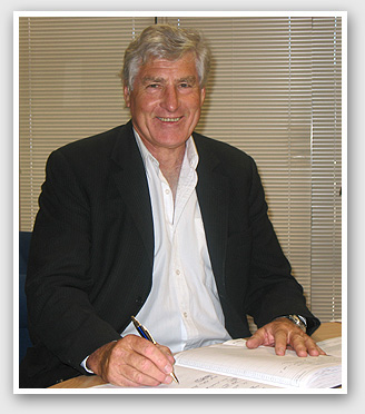
Rogan Hampson |
|
Born 8th of March, 1944 in Rotorua, New Zealand. First employed as a survey cadet by:- Martin H Burrell 1962-64 Worley Downey Muir 1964-66 Mandeno Chitty & Bell 1966-72 Registered as a Member of the New Zealand Institute of Surveyors (MNZIS) in October 1970. Overseas 1972-74 |
Returned to Mandeno Chitty & Bell 1974-77 In New Zealand on the Ruahihi and Mangapapa hydro schemes in Tauranga (the Kaimai Ranges). I carried out the initial topographic surveys, the control surveying for the tunnel setting out, control work within the tunnels and machinery alignment setting out. I also carried out the legalisation surveys for the land taken for canals and roads together with the road closing plans. Started in private practice as Hill & Hampson November 1977 Formed Hampson & Associates Ltd July 1988 We were the survey consultants to the Chase Corporation, Richmond Smart, Aurora Groups, Angus Construction and others. Today we are still doing a similar type of work which is demonstrated by the examples provided. I enjoy my work and my goal for the company is to continue to strive to be the best and to provide innovative solutions that gain our clients an edge in the market place. I have listed some of the ideas or use of the rules where we have been either the first surveyors to carry out such surveys or one of the first companies to do so. We have over the years kept up with technology and we have the latest in modern survey equipment and computer programs. |
Firsts
We always work within the Local Body Rules and the Survey Regulations but at times have had to interpret these to our clients' advantage and as such we have been one of the first surveyors to carry out the following surveys. In 1981 we carried out a couple of the very early unit title surveys for multi storeyed office buildings in Auckland - one at 82 Symonds Street, see DP95320 and at Warspite Street, see DP95591. In 1990 we adopted fresh air and light easements as a way of guaranteeing the fire separation distance between buildings when a boundary was imposed between buildings to place them on separate titles, see DP99443. In 1995 we unit titled the individual car parking spaces within the "Farmers car parking building". We obtained both the land use and subdivision consents, see UP170346. In 1996 we carried out the survey for Quay West in Albert Street Auckland which entailed
|
1993 Planting Easements 1997 Princes Wharf |